News

Welcome to OGC News. You can use the filter below to show only Calls For Participation in or Sponsorship of OGC Initiatives, Requests for Public Comment, General Press Releases, or Blog Posts. Or use the search box to find news on a specific topic.

You may also want to subscribe to the OGC Newsletter: a short digest of news and events sent every two weeks.

All news (1453 match criteria)

Urban Digital Twins – Planning the Cities of Tomorrow

Urban digital twins are not a “solved problem.” Along with increased investment in research and development, the vision demands agreed-upon methodologies and standards, new commitments to data-sharing, -privacy & -ethics, forward-looking regulations, and the development of a robust global community that is as devoted to tradecraft as it is to technology.

OGC Compliance Certification Available for v2.0 of the Observations and Measurements XML Encoding Standard

Products that implement the O&M XML 2.0 Standard and pass the tests in the ETS can now be certified as OGC Compliant.The O&M XML 2.0 standard specifies an XML encoding of the OGC and ISO Observations and Measurements (O&M) conceptual model (also known as ISO 19156).The O&M XML 2.0 standard defines XML schemas for observations, and for features involved in sampling when making observations.More information about the OGC compliance process is available at ogc.org/compliance.Implementers of the O&M XML 2.0 encoding standard – or other OGC standards – can validate their products using the OGC validator tool.

OGC Compliance Certification Available for v2.0 of the Observations and Measurements XML Encoding Standard

The OGC Compliance Program is a certification process that ensures organizations’ solutions are compliant with OGC Standards.

OGC seeks sponsors for a cooperative OGC – IHO Federated Marine SDI Demonstration Pilot

The Open Geospatial Consortium (OGC) is seeking sponsors for a cooperative OGC – IHO Federated Marine SDI Demonstration Pilot.The Federated Marine SDI Demonstration Pilot will show how Marine SDI can unlock valuable data and information for more than the traditional providers and consumers of hydrographic data.Impact on OGC Standards – Lessons learned, gaps, and the need for changes to the OGC Standards Baseline will be summarized in an Engineering Report that will inform the OGC Standards Program.Impact on IHO Standards – Practical testing of relevant S-100 based IHO standards will accelerate the process for adoption and implementation of IHO standards.To express interest in sponsoring the pilot or for more information, visit the OGC – IHO Federated Marine SDI Demonstration Pilot page on the OGC website.

OGC seeks sponsors for a cooperative OGC – IHO Federated Marine SDI Demonstration Pilot

New Pilot will demonstrate a multi-country, federated Marine Spatial Data Infrastructure for land/sea interface use-cases.

OGC Introduces Visiting Fellow Program

OGC Visiting Fellow(s) will bring diversity to OGC’s technical and market thought-leadership, keeping the Consortium responsive and proactive to our community’s – and wider society’s – needs.

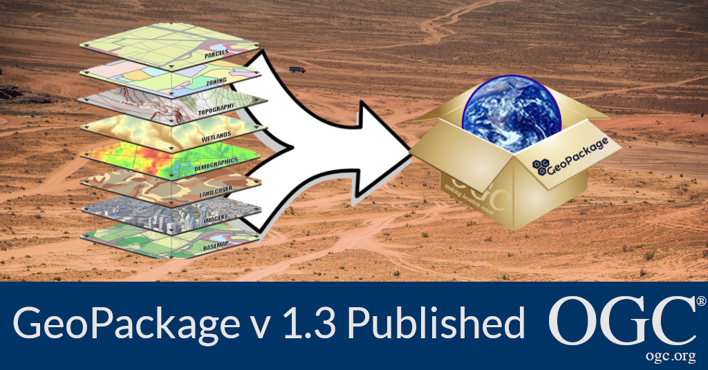
OGC Membership approves and publishes minor update to GeoPackage

V1.3 is a minor update to GeoPackage, the open, standards-based, platform-independent, portable, self-describing, compact format for transferring geospatial information.The Open Geospatial Consortium (OGC) membership has approved and published the latest version of the GeoPackage Standard, v1.3.0.GeoPackage version 1.3.0 is a minor revision to the current version 1.2.1.As with any OGC standard, the open GeoPackage standard is free to download and implement.Interested parties can view the standard on the OGC GeoPackage Standard Page.

OGC Membership approves and publishes minor update to GeoPackage

V1.3 is a minor update to GeoPackage, the open, standards-based, platform-independent, portable, self-describing, compact format for transferring geospatial information.

OGC membership approves new Community Standard: Indoor Mapping Data Format (IMDF)

The Open Geospatial Consortium (OGC) membership has added Indoor Mapping Data Format (IMDF) 1.0.0 to the OGC Standards Baseline as a Community Standard.Indoor Mapping Data Format (IMDF) makes it possible for anyone to create indoor map apps and services using the same highly accurate and detailed data on any app, website, or operating system.Now an OGC Community Standard, Indoor Mapping Data Format provides a mobile-friendly, compact, human-readable, temporally aware, highly extensible data model for any indoor space, providing a basis for orientation, navigation, and discovery.An OGC Community Standard is an official standard of OGC that was already available as a widely used, mature specification, but was developed outside of OGC’s standards development and approval process.As with any OGC standard, the Indoor Mapping Data Format (IMDF) OGC Community Standard is free to download and implement.

Sign up today

Receive the latest news on OGC.

© 2024 Open Geospatial Consortium. All Rights Reserved.

Become a memberBecome a member