News

Welcome to OGC News. You can use the filter below to show only Calls For Participation in or Sponsorship of OGC Initiatives, Requests for Public Comment, General Press Releases, or Blog Posts. Or use the search box to find news on a specific topic.

You may also want to subscribe to the OGC Newsletter: a short digest of news and events sent every two weeks.

All news (1453 match criteria)

OGC Members Revise IoT Standard SensorThings API Part 1 – Sensing; Public Comment Sought

The Open Geospatial Consortium (OGC) seeks public comment on Version 1.1 of the OGC SensorThings API, Part 1 – Sensing.The OGC SensorThings API provides an open, geospatially enabled, unified way to interconnect Internet of Things (IoT) devices, data, and applications over the web.At a high level, the OGC SensorThings API provides two main functionalities, with each function handled by a specific part of the standard: Sensing and Tasking.The candidate ‘SensorThings API Part 1 – Sensing’ v1.1 standard is available for review and comment on the OGC Portal.For anyone interested in learning more about the SensorThings API, the SensorThings API Domain Working Group chair, Steve Liang, recently presented an overview of SensorThings, including how it’s being used during COVID-19.

OGC Members Revise IoT Standard SensorThings API Part 1 – Sensing; Public Comment Sought

Version 1.1 is a minor update to OGC’s IoT standard, which is used across the globe in logistics, public safety, energy utilities, environmental monitoring, and more.

OGC adopts Extension to its Moving Features Standard, enabling JSON Encoding

New Moving Features Extension provides a JSON encoding as an alternative to XML or CSV

OGC adopts Extension to its Moving Features Standard, enabling JSON Encoding

New Moving Features Extension provides a JSON encoding as an alternative to XML or CSVThe Open Geospatial Consortium (OGC) is excited to announce that the OGC Membership has approved the Moving Features Encoding Extension – JSON for adoption as an official OGC Standard.OGC Moving Features Encoding Extension – JSON provides an IETF GeoJSON encoding for OGC Moving Features as an alternative to XML or CSV encodings.The JSON Encoding Extension supports, 0- (point trajectories), 1- (lines), 2- (polygons), and 3-dimensional (polyhedrons) objects with locations and/or properties that vary over time.As with any OGC standard, the open OGC Moving Features Encoding Extension – JSON is free to download and implement.Interested parties can view and download the standard from OGC’s Moving Features Standard Page.

US Federal Aviation Administration (FAA) upgrades to highest level of OGC Membership

FAA upgrades to OGC’s highest level of membership to help drive standards and shape development priorities relevant to aviationThe Open Geospatial Consortium (OGC) is pleased to announce that the United States Federal Aviation Administration (FAA) has raised its membership level from Technical to Strategic – OGC’s highest level of membership.FAA will also participate in final approval decisions for all OGC standards and nominations to the Board of Directors.Further, FAA will work with other Strategic Members as part of an OGC Strategic Member Advisory Committee to help identify and advance high priority areas of interoperability concern.OGC CEO Nadine Alameh commented “Its great to see the FAA joining other OGC Strategic Members to lead the way in making location information Findable, Accessible, Interoperable, and Reusable (FAIR).OGC members together form a global forum of experts and communities that use location to connect people with technology and improve decision-making at all levels.

US Federal Aviation Administration (FAA) upgrades to highest level of OGC Membership

FAA upgrades to OGC’s highest level of membership to help drive standards and shape development priorities relevant to aviation

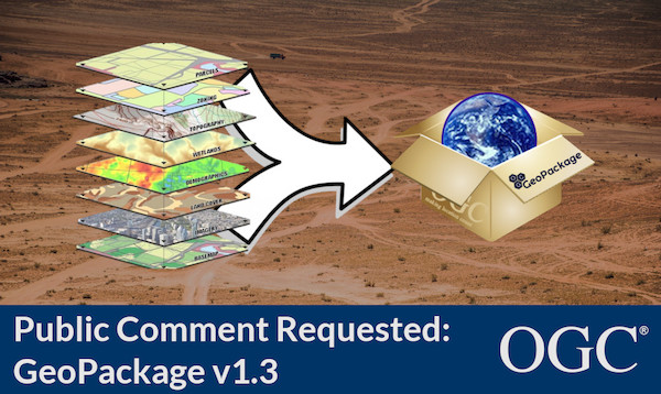
OGC seeks public comment on Version 1.3 of GeoPackage Standard

V1.3 is a minor update to GeoPackage, the open, standards-based, platform-independent, portable, self-describing, compact format for transferring geospatial information.Open Geospatial Consortium (OGC) seeks public comment on the latest version of the GeoPackage Standard, v1.3.0.GeoPackage is an open, standards-based, platform-independent, portable, self-describing, compact format for transferring geospatial information.GeoPackage version 1.3.0 is a minor revision to the current version 1.2.1.The candidate GeoPackage version 1.3 standard is available for review and comment on the OGC Portal or GeoPackage GitHub page.

OGC seeks public comment on Version 1.3 of GeoPackage Standard

V1.3 is a minor update to GeoPackage, the open, standards-based, platform-independent, portable, self-describing, compact format for transferring geospatial information.

OGC and W3C invite web developers to a joint workshop series on Maps for the Web

Workshops will bring together experts in browser development, Web standards, and Web mapping client tools & applications to explore the potential of standardized maps for the Web.The Open Geospatial Consortium (OGC) and the World Wide Web Consortium (W3C) invite interested stakeholders to participate in a W3C/OGC Joint Workshop Series on Maps for the Web, in September & October, 2020.Contributors are needed to help build new web standards for maps in the browser.These workshops will bring together experts in browser development, Web standards, and Web mapping client tools & applications to explore the potential of standardized maps for the Web.Participants in this workshop series, as in all W3C activities, are expected to follow the W3C code of ethics and professional conduct.

Sign up today

Receive the latest news on OGC.

© 2024 Open Geospatial Consortium. All Rights Reserved.

Become a memberBecome a member